richmond, ca
summer 2026
- course
- MUD Summer Studio, UC Berkeley
- team
- Avani Mandpe, Lizzy Kemp, Kaihong Cui
- my role
- Buffer mapping, the Point Richmond seam with Kaihong Cui, collages
- tools
- ArcGIS Pro, Rhino, Photoshop, Illustrator
planning brief / 01
Richmond’s refinery is ringed by fenced buffer land. How much is there, who controls it, and which pieces could become public?
methods + data
- Contra Costa County parcel data in ArcGIS Pro, filtered by size and land use
- A buffer matrix comparing every site by type, contents, edges and connections
- California Protected Areas data to separate public land from private
- Field visits, sections and Setha Low’s public space toolkit at the Point Richmond knoll
what we found
- 01485 acres of buffer land across 27 parcels; the largest single parcel is 179 acres.
- 02Most of the fenced buffer is a handful of very large Chevron parcels.
- 03The small parcels a neighborhood could realistically use are mostly public land at Point Molate and Point San Pablo.
- 04At Point Richmond, the buffer between the tank farm, Interstate 580 and homes keeps people out but not the air.
what we recommend
- 01Open City owned parcels of 15 acres or less first, where public access is realistic.
- 02Treat buffers as shared infrastructure: filter planting, carbon capture and public paths on the same land.
- 03Put a community air monitor on the fenceline so residents can see what the buffer does and doesn’t stop.
- 04Turn the Point Richmond knoll into a terraced public garden linking the village to a hilltop plaza.
01.1
stitched city
Richmond’s refinery, freeways and rail lines leave long strips of fenced land between heavy industry and the homes beside it.
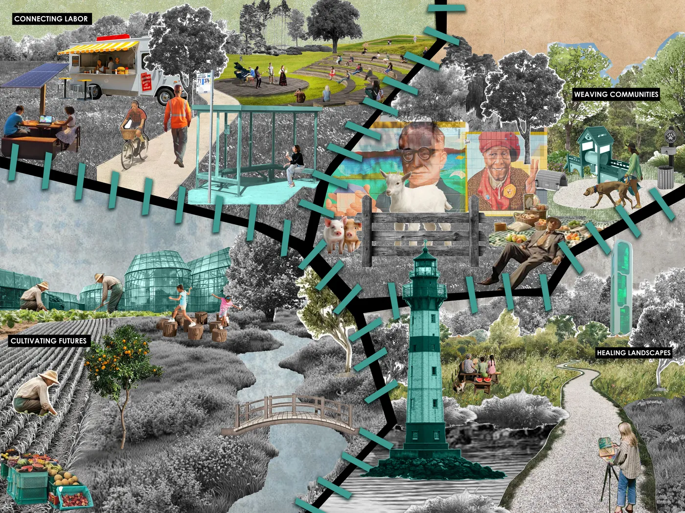
Our studio read the city through those edges and proposed stitching them back in as public seams that workers and neighbors share.
01.2
buffer lands
I mapped the land that keeps the refinery and its neighbors apart from Contra Costa County parcel data in ArcGIS Pro, kept parcels small enough for a neighborhood to use, and sorted each one by why it exists.
485 acres across 27 parcels.
- my role
- GIS mapping; matrix with the team
- data
- County parcels, CPAD
01.3
the lungs
The knoll between the Chevron tank farm, Interstate 580 and Point Richmond is a buffer that stops people but not air.
Four moves turn it into lungs for the neighborhood: a redwood filter belt, old oil silos reused as algae ‘liquid trees’, a carbon capture lighthouse and a community air monitor.
- course
- Exercise 2d, Nodes and Catalysts
01.4
the chevron seam
On the hill above Point Richmond, a terraced garden climbs from the houses to a hilltop plaza where an Atlas figure honors the refinery’s workers.
Carbon capture plants sit on the brow; three glass domes at the foot of the hill give the first clean breath.
- team
- With Kaihong Cui
next / 02
cultivated urbanism
merced, ca · fall 2026