merced, ca
fall 2026
- course
- ENVDES 201 Advanced Urban Design Studio
- team
- Miguel Cruz, Yimei Zheng, Yun-Ying Chiu
- my role
- Station and agrihood maps, density study, title collage, storyboard
- tools
- Photoshop, Illustrator, Esri and NAIP aerials
planning brief / 02
California’s high speed rail will stop in Merced. How can the city grow around a station without spreading over the farmland that defines it?
methods + data
- The state’s draft 2026 rail business plan and the Legislative Analyst’s Office review
- Routing from the platform to Downtown 2.0 on real roads
- A framework drawn on a one hectare grid over USDA NAIP aerials
- A density comparison: one acre each of a Merced tract, our agrihood and Barcelona
what we found
- 01The draft plan moves the station south onto unincorporated land at Highway 99 and Mission Avenue.
- 02From the platform to Downtown 2.0 is 2.2 miles by road.
- 03The relocated station would not serve ACE or San Joaquins (Gold Runner) trains; those riders would transfer at Madera.
- 04Our agrihood reaches about 13 homes an acre, more than double a typical Merced tract (5), and keeps its orchard.
what we recommend
- 01Concentrate growth on one spine from the station to UC Merced instead of letting it spread.
- 02Build small agrihoods along the spine: apartments and townhouses on the edges, working farmland in the middle.
- 03Run transit, bike paths and farm stands along the spine so the station, downtown and campus connect.
- 04Treat the missing ACE and San Joaquins connection as the station’s biggest gap and plan for it early.
02.1
the spine
California’s high speed rail will stop in Merced, a Central Valley farm town of about 90,000.
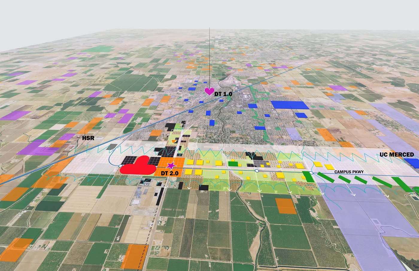
Instead of letting growth spread over farmland, our team drew one spine from the new station to UC Merced and packed new homes into small ‘agrihoods’ along it.
02.2
station to field
The station sits outside the framework, so I traced the route from the platform to Downtown 2.0 on real roads: 2.2 miles.
The title image breaks today’s aerial into the team’s one hectare cells.
- my role
- Station map, title collage
02.3
the first agrihood
Four hectares north of Downtown 2.0. The orchard stays; apartments and townhouses line the edges and the middle stays in crops.
About 13 homes an acre: denser than a Merced tract (5), nowhere near Barcelona (60).
- my role
- Agrihood plan, density study
02.4
a tomato, 70 days
One tomato’s trip through the framework, drawn as a comic: planted in an agrihood, grown by Hmong farmers, picked with UC Merced students, hauled up the spine by Tilly the Tractor, eaten on campus and back to the soil.
- my role
- Story and layout for the team midterm
next / 03
the fence line
san francisco · summer 2026